
A fleet operator needed to know where its trucks were at all times, and to hear about it straight away when a vehicle left the area it was meant to be in. Virstack built a geofencing platform that connects GPS devices fitted to every vehicle with a map-based dashboard, where operators draw zones, set rules and receive alerts in real time.
Location data on its own was not enough. The operator needed a way to turn a constant stream of GPS positions into clear, actionable alerts, without staff watching a map all day. The platform had to receive data from many moving vehicles reliably, check every update against the zones the operator had defined, and notify the right person immediately.
- Receiving continuous location data from GPS devices across the fleet in real time
- Letting operators define zones and rules themselves, without code changes
- Checking every position update against active geofences with minimal delay
- Alerting vehicle owners the moment a rule is broken
- Keeping the platform reliable as the number of vehicles grows
Technology Stack
-

Field Devices
GPS trackers fitted to fleet vehicles -

Messaging
MQTT protocol -

Telemetry
OpenTelemetry -

Dashboard
Interactive map with polygon drawing
Virstack developed a geofencing platform that streams vehicle locations in real time, checks them against operator-defined zones and rules, and alerts owners as soon as a vehicle breaks a rule.
GPS Tracking Across the Fleet
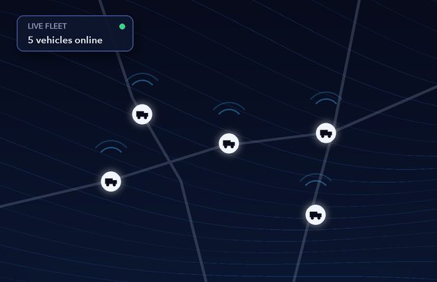
GPS devices on each vehicle report their position continuously, giving operators a live view of the whole fleet on one map.
Zones Drawn on the Map
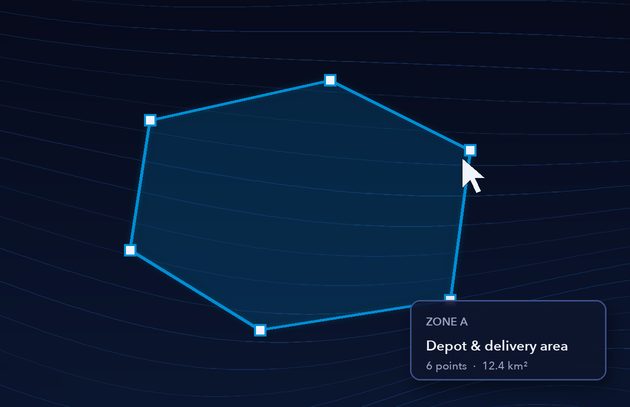
Operators draw polygons directly on the dashboard map to define where each vehicle, or group of vehicles, is allowed to operate.
Rules for Every Zone
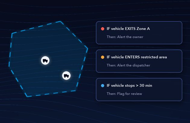
Each zone carries its own rules, such as alert when a vehicle leaves its area or enters a restricted one. Every incoming position is checked against the active rules.
Real-Time Data and Alerts
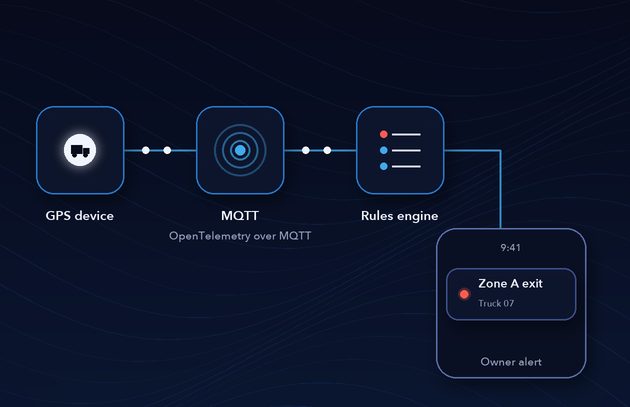
Location data arrives through OpenTelemetry over MQTT, a lightweight messaging protocol built for connected devices. When a rule is triggered, for example a truck moving outside its assigned area, the owner is alerted immediately.
The platform gave the operator continuous, rule-based oversight of the fleet without manual monitoring.
-

Immediate alerts when a vehicle leaves its assigned area
-
Live visibility of every vehicle on a single map dashboard
-
Zones and rules managed by the operator, with no code changes
-
Faster response to unauthorized or unexpected vehicle movement
-
A foundation that extends to other assets, sites and alert types